Feb 2019
We've published our latest significant version release. Key features are outlined below.
To use the new version, use the link: andersonopt.com rather than v3.andersonopt.com. Your work saves across versions, so don't worry about losing anything between versions.
Features
- Toggle Layers from the Map:
- Purpose: Now you can toggle layers and add drawings without leaving full screen view
- How-To: Double right-click on a map to display the layer manager. Click the "Turn on/off edit mode" button to toggle polygon the drawing features.

- Filtering Parcel List Updates Project Map
- Purpose: Allows users to see where parcels are in relation to each other and the initial substation/line
- How-To: Filter the parcel list in any way

- Disable Layer Queries
- Purpose: If layers overlap and a user clicks an element, it currently displays multiple info boxes. When you disable the query, the detailed info box won't pop up, but you can still see the layer and only the desired pop up
- How To: Click "Disable Query" when you turn a layer on
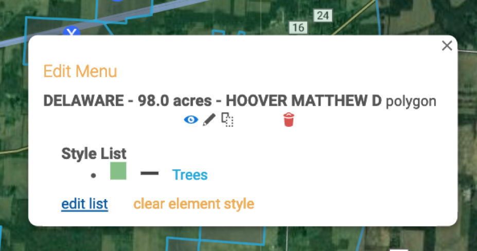
- Edit Polygon Design From Map
- Purpose: Allows users to edit and style polygons without leaving the map
- How to: Single right-click on a polygon to display the edit menu
- Map Styles Based on Rating
- Purpose: This allows users to see their highly and lowly rated parcels on the project map and differentiate them from one another.
- We currently have this feature where styles are based on ratings but we can remove it or apply styling based on other attributes as well.
- How-To: Apply a star rating to a parcel and refresh project page

- Purpose: This allows users to see their highly and lowly rated parcels on the project map and differentiate them from one another.
We've also made many smaller enhancements and bug fixes. We'll be publishing a few more in the next few days.
Please reach out with any questions or training requests. Also, if you encounter any bugs, let us know, and we'll fix them right away.